Mysteries RV Project:

Target #4c: The viewer should explore and describe the event or process that resulted in the target to be located at the bottom of the ocean, as shown in the image below. The target time should be the time that best reveals the cause and nature of the event or process.

Target 4 Image


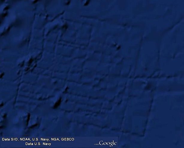
Image Credit: Google Earth
Latitude: 31.386560°
Longitude: -24.462754°


Scientific Remote Viewing®, SRV®, and Farsight® are internationally registered service marks of Farsight, Inc. The Farsight ProtocolsSM is a service mark of Farsight, Inc. Session Analysis Machine™ and SAM™ are trademarks of Farsight, Inc.
This entire site is Copyright © 1996-2024 Farsight, Inc. All rights reserved.
DISCLAIMER
URL: https://farsight.org