Mysteries RV Project:

Target #4e: The viewer should explore and describe what the target below looked like when whatever caused the patterns shown in the image below was at its peak or optimal state.

Target 5 Image


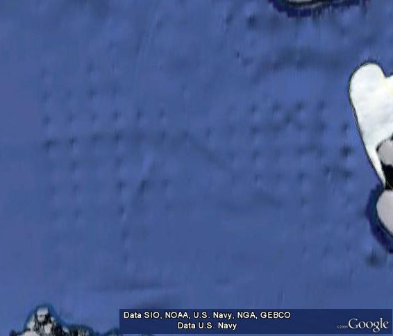
Image Credit: Google Earth
Latitude: -71.685035°
Longitude: -77.261423°


Scientific Remote Viewing®, SRV®, and Farsight® are internationally registered service marks of Farsight, Inc. The Farsight ProtocolsSM is a service mark of Farsight, Inc. Session Analysis Machine™ and SAM™ are trademarks of Farsight, Inc.
This entire site is Copyright © 1996-2024 Farsight, Inc. All rights reserved.
DISCLAIMER
URL: https://farsight.org